Rising Beyond Traditions: Monitoring Kenyan Soils and Ecosystems Using Non-Invasive Seismic Technology

Morine Wangechi
Research Scientist
Agriculture in Kenya heavily relies on fertilizers, and traditional soil sampling methods have been extensively used to monitor and quantify soil health. The Earth Rover Program (ERP), a not-for-profit organisation, aims to empower farmers to sustain high yields while minimising interventions. ERP has leveraged traditional seismic technologies for non-invasively “seeing” into the soil.

The Kenyan hub, established in collaboration with the Centre for Ecosystem Restoration Kenya (CER-K), is actively running seismic surveys across Kenyan soils and agro-ecosystems.

Currently working as a research scientist in seismology for the Earth Rover Program in collaboration with the Centre for Ecosystem Restoration-Kenya (CER-K), I hold a bachelor's degree in geophysics from Jomo Kenyatta University of Agriculture and Technology (JKUAT). My enthusiasm for soil science, agriculture, and environmental action has been greatly informed by my professional journey. Early in my career, I interned in the biogas sector optimising renewable energy production from agricultural waste. This propelled my interest in sustainable agriculture, leading to a Sustainability Assistant position in commercial agriculture. Here I extensively applied precision agriculture and sustainability principles in large-scale farming, ensuring resource efficiency and climate resilience. My quest for a data-driven approach led me to the oil and gas industry, where I was largely involved in geophysical data acquisition and analysis for resource mapping.
Two years ago, if someone had told me that we could use geophysical methods and, in particular, seismics to study the soil, I would have been totally skeptical. I would have struggled to imagine how this technology that had been used broadly in exploration geophysics to image the deep subsurface could now be adapted for soils in a completely non-invasive way. This has changed since I discovered the Earth Rover Program’s seeing-into-the-soil work and got to be part of the great team changing soil health narratives. My current work applies geophysical techniques in the soil and ecosystem fields through repurposing deep-subsurface imaging to shallow high-frequency waves that map soil structure, accelerating evidence-informed agriculture.
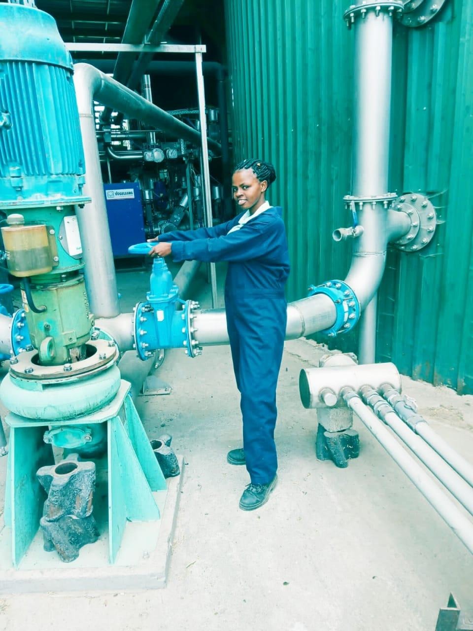 | 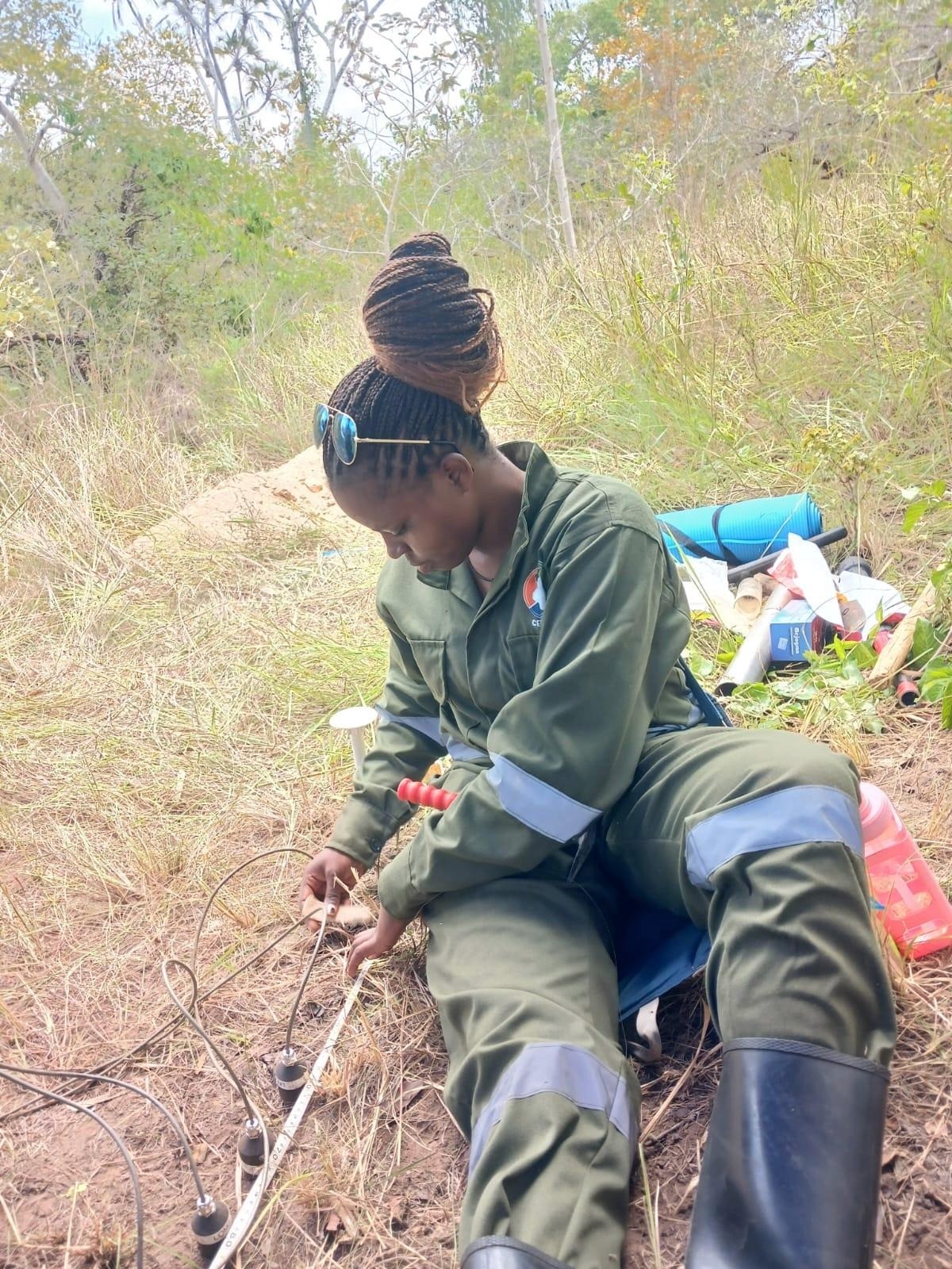 |
Figure 1—Creating a positive impact across different sectors
All about CER-K:
The Centre for Ecosystem Restoration-Kenya (CER-K) is a Kenyan non-profit organization with a major focus on restoring biodiverse ecosystems. We envision a future of resilient ecosystems and thriving communities where people and nature live in harmony. This is made possible through action-oriented research and improved access to quality resources and best practice restoration. We currently have operations across the country's highlands, savannah, and coastal regions.
The Highland hub is located in Limuru, Kenya, on the southern tip of the Aberdares, in the central highlands of Kenya, and is surrounded by a 40 ha restored forest and vast tea landscapes. The Savannah hub is in the heart of Africa’s most famous wildlife ecosystem, the Maasai Mara, a home to a great diversity of wildlife, including lions, elephants, cheetahs, and the annual epic migration of wildebeest. It is also highly characterized by savannah grasslands. The coastal hub is in Kilifi, a coastal zone along the Indian Ocean characterised by vast mangroves and coral reefs. The main interest across all these hubs is the restoration of native tree species, restoring degraded lands, soil regeneration, seed banking and collection, and nursery management.
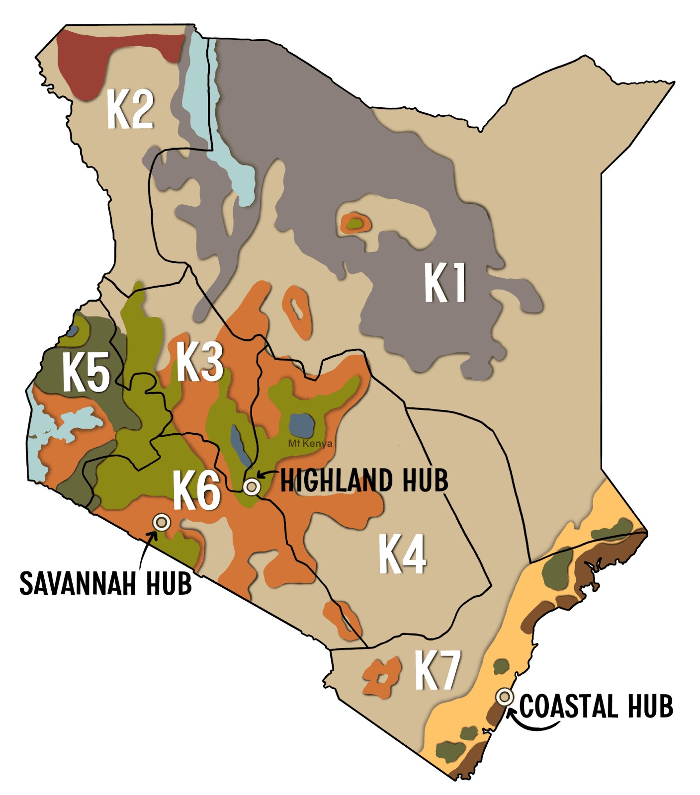
Figure 2—A map showing the CER-K hubs within the 7 floristic regions. Source: CER-K website
Soil seismic experiments across Kenyan agroecosystems
We have been carrying out non-invasive soil seismic field surveys across Kenyan agro-ecosystems since January 2025, and our passion for soil health monitoring and quantification has fueled us into covering different agro-ecosystems and soil types, and we are on a quest to cover even more and expand beyond Kenya. We aim to better understand the soil structure and hence empower farmers and sustain both soil health and crop production.
The Rationale
Rachel Carson, an American biologist and writer, once said, “The real wealth of the nation lies in the resources of the earth, soil, water, forests, minerals, and wildlife.” Indeed, soil is a valuable resource, a vital component that plays key roles, including sustaining living organisms, nutrient cycling, erosion resistance, water regulation, biodiversity promotion, and carbon sequestration. It is significant to note that soil is not dirt, as referred to by most people, but a living, breathing ecosystem that is a habitat for billions of microbes and plays a significant role in our day-to-day life. It takes hundreds to thousands of years to form a centimeter of healthy soil but just a single heartbeat to wash it away.
The functionality and productivity of the soil depend on soil health. When soil is degraded due to factors like excessive tillage, nutrient depletion, or erosion, its capacity to perform optimally reduces, negatively impacting crop agricultural productivity and ecosystem resilience. Soil health must be continually assessed in a non-invasive way to ensure minimal disturbance
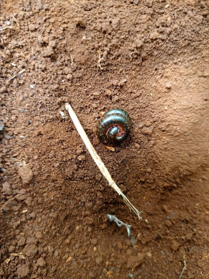
Figure 3 - A soil image captured in one of our field surveys in Nyeri, Kenya, showing an indication of healthy soils.
Practicalities
Experimental setup
Soil seismics is an interesting topic; imagine peering into the soil as you would in health ultrasounds to reveal a baby’s hidden world or music sounds through air to create rhythms. The seismic sound waves are generated by hitting a metal plate coupled with the ground with a small hammer and sent into the ground. Geophone sensors in a 2m linear array and 10 cm interspacing detect these wave arrivals as time-series traces like beat lines. The sensors are connected to a LOM box with audio interfaces, which is then connected to a field laptop for data storage. The sensor arrangement may vary depending on the resolution aimed at, and this has been done practically in various ERP seismic experiments. By passing these ultrahigh-frequency seismic waves through the soil, we can observe structure, moisture, and bulk density without digging or disturbing the soil.
Since we are still in the early stages, we are also collecting complementary soil data for ground truthing. For conventional soil sampling, we are using a soil corer to a depth of 60 cm below the surface. This is done along the seismic line, and the soil samples are analyzed for physical and chemical properties for correlation with the seismic data.
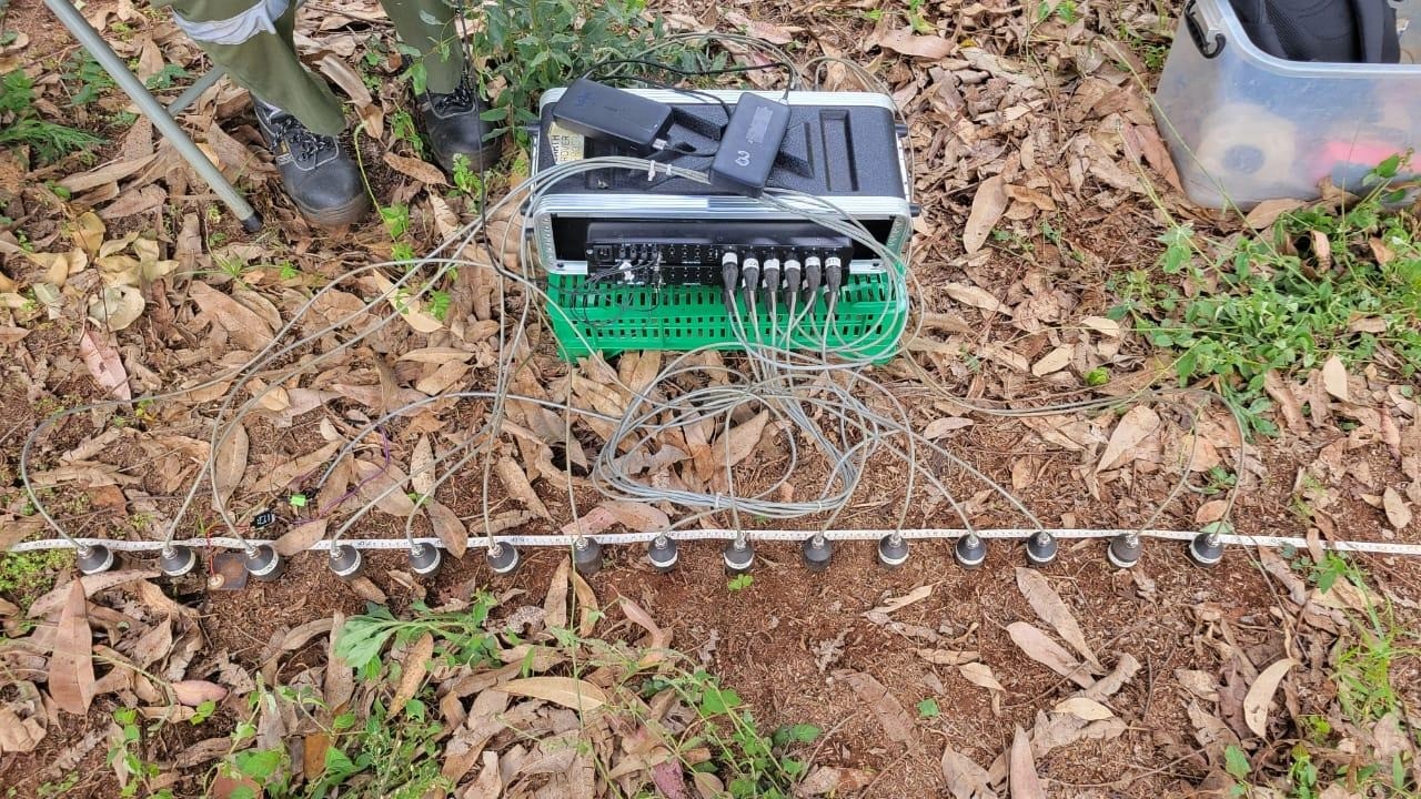
Figure 4—LOM Geophones sensor arrangement
Ecosystems covered: Drylands, Coastal, and Highlands
Kenyan ecosystems differ widely based on the climatic conditions, rainfall amounts received, agricultural potential and crop types, elevation, and soil and vegetation types. The sites we have covered so far can be classified broadly into three ecosystem types: the drylands, highlands, and coastal ecosystems.
Highlands
The highlands of Kenya offer the most favorable climatic conditions, with the agro-climatic zones ranging from the cool humid zones to the moderate sub-humid ones. They are elevated regions encompassing the mountains, forests, and ranges, i.e., Mt. Kenya and the Aberdare ranges. Offering the most suitable conditions and temperatures, they are known to be Kenya’s breadbasket zones. The high to bimodal rainfall received here enables year-round farming with minimal irrigation, best suitable for crops like coffee, tea, maize, and horticultural crops. Most of the soils here are fertile and well-drained volcanic soils that are nutrient-rich. We have sampled various sites in the highlands, ranging from the shores of Aberdare Ranges to those of Mt. Kenya. We have an experiment running every two weeks at Forestfoods Organic Garden Limuru, a site embracing syntropic agriculture with an aim to monitor time-dependent changes in soil through seismics. We have also sampled the Brackenhurst Indigenous and Exotic forest, two sites in Nyeri, and one in Nyandarua. We also aim to cover the highlands of western Kenya.
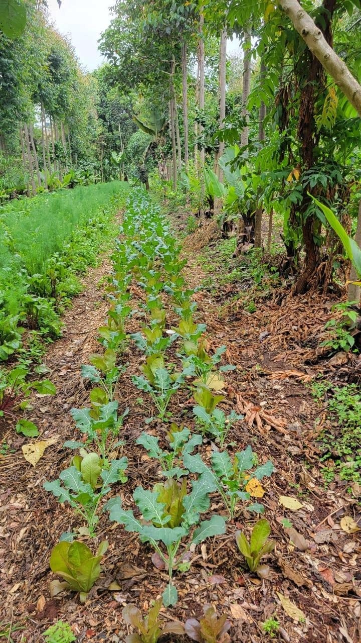
Figure 5—One of the sites we have been experimenting at Forestfoods Organic Garden, Limuru
Drylands
These include the arid and semi-arid regions of Kenya. Most Northern and Eastern parts of Kenya fall under this category. The drylands receive low and unreliable rainfall, and therefore most farmers rely on irrigation. Some parts receive frequent droughts and very high evaporation rates. Soils in these zones are sandy, less fertile, and have low water retention potential. Crops grown here are mainly drought resistant, i.e., millet and sorghum, with a few farmers planting maize. Pastoralism is considered a means of livelihood in these areas. Our dryland surveys spanned Machakos, Laikipia (Mpala), and Enarau Conservancy (arid to semi-humid transition zone). More expansive surveys will be conducted to cover the arid and very arid zones.
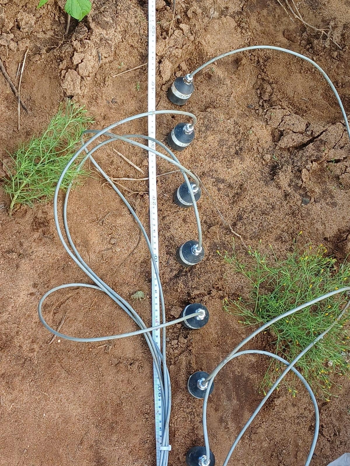
Figure 6—Sandy soils covered in the Machakos region
Coastal ecosystems
The coastal region is characterised by a tropical climate influenced by the Indian Ocean. The annual rainfall varies from low in the arid and semi-arid parts to higher rainfall in the wetter zones. This is majorly linked to the monsoon wind systems. The area is also dominated by coral limestones, sandstones, and shales. Dominant crops include sisal, cassava, sugarcane, and rice, with much farming being rainfed and therefore seasonal. The region has diverse soil types, which vary from sandy and saline near the shore to rich, loamy soils inland. Our surveys in Kilifi and Shimba Hills covered the soil and climatic diversity.
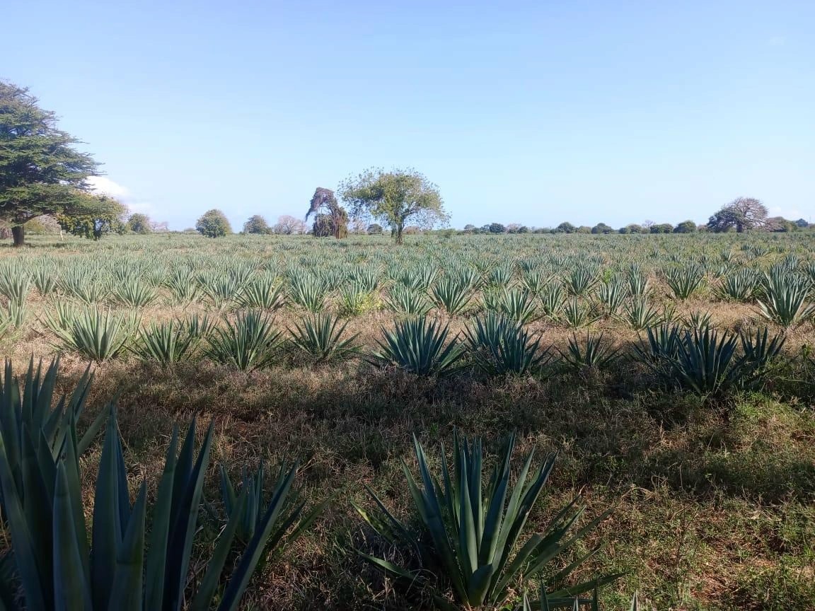
Figure 7—A sisal plantation at the Kilifi Plantation Limited
How is Seismic technology changing the way we view soil health
With over a year of deploying non-invasive seismic technology and sending waves beneath the soil across Kenya’s diverse ecosystems, I am convinced that this technology will change soil health from a silent mystery to a data-driven and evidence-based practice.


